
XYZ Format Map Tiles
XYZ tiles support JPG (JPEG) and PNG formats. PNG with transparency is recommended.
Data Acquisition
XYZ tiles can be obtained using the following methods:
- Method 1: Download tiles using map tools such as MobileAtlasCreator, Shui Jing Wei Tu, or Tai Le Di Tu.
- Method 2: Convert TIF imagery containing coordinate system information to XYZ tiles.
Note: Some online map data sources may have coordinate offsets. Verify the coordinate accuracy of the selected data source.
Data Publishing - Visualized Operation
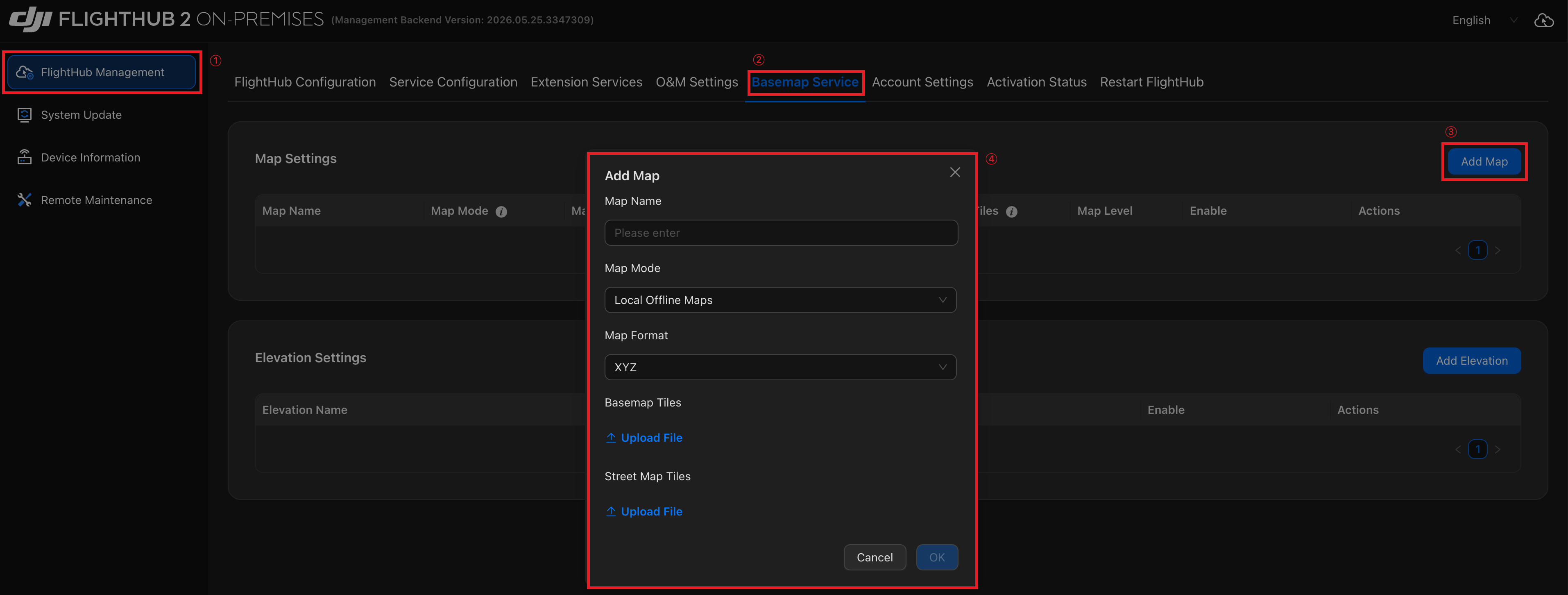
Log in to the Admin Console and follow these steps to add a map:
- Go to 「FlightHub Management」→「Basemap Service」→「Add Map」.
- Set 「Map Mode」 to "Local Offline Maps".
- Set 「Map Format」 to "XYZ".
- Upload the tile files and click 「OK」.
Tip: For instructions on logging in to the Admin Console, see "Accessing the AIO Admin Console".